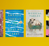
National Geographic Collegiate Atlas of the World, Second Edition

Hardcover
$40.00 US
9.35"W x 11.16"H x 1.19"D  
On sale Aug 16, 2011 | 400 Pages | 978-1-4262-0839-3
As a second edition of a successful National Geographic atlas creation, the new Collegiate Atlas is fresh with the latest developments in the political and natural world and brings modern visual clarity and topical content--in a succinct presentation--to a world rich with geographic data and information.

Two opening spreads in the front matter help the reader to better interpret images and new data. “Remote World” introduces readers to data collection via remote sensing and GPS technology. “Understanding Our World Spatially” follows, covering data processing and analysis as it relates to mapping and using GIS technology (Geographic Information Systems). These explanatory introductory pieces provide the foundation for students to gain insight into modern-day map making, which is reflected in the content of the colorful, engaging, fact-filled spreads that lie ahead.

The atlas also addresses the traditional subjects of map scales, projections, and map reading skills. Based on feedback from more than 100 professors, educational reviewers, and other consultants, we have added special thematic map spreads addressing each Continental Economy. In addition–within each continent–physical, political, and regional mapping is presented at the same scale, which allows the reader to compare map information easily and accurately. This feature of a fixed scale for regions provides the reader the option to roam from one end of a continent to its other end, flipping through the pages, while maintaining a constant scale.

Careful selection of place-names and features make the maps very informative but not overly cluttered. Computer-generated shading enhances the look of the political maps while providing valuable information on topography. The ocean floors of the world are dramatically portrayed with bathymetric relief paintings. And lastly, world political information, statistics, geographic comparisons, and glossaries are organized in easy-to-use sections in the back matter.
NATIONAL GEOGRAPHIC is one of the world’s leading nonfiction publishers, proudly supporting the work of scientists, explorers, photographers, and authors, as well as publishing a diverse list of books that celebrate the world and all that is in it. National Geographic Books creates and distributes print and digital works that inspire, entertain, teach, and give readers access to a world of discovery and possibility on a wide range of nonfiction subjects from animals to travel, cartography to history, fun facts to moving stories. A portion of all National Geographic proceeds is used to fund exploration, conservation, and education through ongoing contributions to the work of the National Geographic Society.

About

As a second edition of a successful National Geographic atlas creation, the new Collegiate Atlas is fresh with the latest developments in the political and natural world and brings modern visual clarity and topical content--in a succinct presentation--to a world rich with geographic data and information.

Two opening spreads in the front matter help the reader to better interpret images and new data. “Remote World” introduces readers to data collection via remote sensing and GPS technology. “Understanding Our World Spatially” follows, covering data processing and analysis as it relates to mapping and using GIS technology (Geographic Information Systems). These explanatory introductory pieces provide the foundation for students to gain insight into modern-day map making, which is reflected in the content of the colorful, engaging, fact-filled spreads that lie ahead.

The atlas also addresses the traditional subjects of map scales, projections, and map reading skills. Based on feedback from more than 100 professors, educational reviewers, and other consultants, we have added special thematic map spreads addressing each Continental Economy. In addition–within each continent–physical, political, and regional mapping is presented at the same scale, which allows the reader to compare map information easily and accurately. This feature of a fixed scale for regions provides the reader the option to roam from one end of a continent to its other end, flipping through the pages, while maintaining a constant scale.

Careful selection of place-names and features make the maps very informative but not overly cluttered. Computer-generated shading enhances the look of the political maps while providing valuable information on topography. The ocean floors of the world are dramatically portrayed with bathymetric relief paintings. And lastly, world political information, statistics, geographic comparisons, and glossaries are organized in easy-to-use sections in the back matter.

Author

NATIONAL GEOGRAPHIC is one of the world’s leading nonfiction publishers, proudly supporting the work of scientists, explorers, photographers, and authors, as well as publishing a diverse list of books that celebrate the world and all that is in it. National Geographic Books creates and distributes print and digital works that inspire, entertain, teach, and give readers access to a world of discovery and possibility on a wide range of nonfiction subjects from animals to travel, cartography to history, fun facts to moving stories. A portion of all National Geographic proceeds is used to fund exploration, conservation, and education through ongoing contributions to the work of the National Geographic Society.

PRH Education High School Collections

All reading communities should contain protected time for the sake of reading. Independent reading practices emphasize the process of making meaning through reading, not an end product. The school culture (teachers, administration, etc.) should affirm this daily practice time as inherently important instructional time for all readers. (NCTE, 2019)   The Penguin Random House High

Read more

PRH Education Translanguaging Collections

Translanguaging is a communicative practice of bilinguals and multilinguals, that is, it is a practice whereby bilinguals and multilinguals use their entire linguistic repertoire to communicate and make meaning (García, 2009; García, Ibarra Johnson, & Seltzer, 2017)   It is through that lens that we have partnered with teacher educators and bilingual education experts, Drs.

Read more

PRH Education Classroom Libraries

“Books are a students’ passport to entering and actively participating in a global society with the empathy, compassion, and knowledge it takes to become the problem solvers the world needs.” –Laura Robb   Research shows that reading and literacy directly impacts students’ academic success and personal growth. To help promote the importance of daily independent

Read more